
UAV Flight-Path Mapping Software
UAV Flight-Path Mapping Software
UAV Flight-Path Mapping Software
UAV Flight-Path Mapping Software
UAV flight-path mapping software helps operators design safer drone corridors by quantifying population exposure and identifying sensitive POIs. With Population Explorer, you can buffer planned routes, compare alternatives, and export audit-ready shapefiles and reports. Smarter corridor planning reduces risk, accelerates approvals, and supports reliable UAV operations at scale.
UAV flight-path mapping software helps operators design safer drone corridors by quantifying population exposure and identifying sensitive POIs. With Population Explorer, you can buffer planned routes, compare alternatives, and export audit-ready shapefiles and reports. Smarter corridor planning reduces risk, accelerates approvals, and supports reliable UAV operations at scale.
Precision GIS Software
Why drone flight-path mapping matters
Why drone flight-path mapping matters
UAV flight-path mapping enables operators to design safe, compliant flight corridors. By quantifying population exposure along flight paths, organizations can reduce risk, meet regulatory standards, and plan efficient drone operations with confidence.
Population Exposure Along Routes
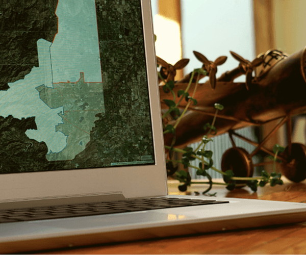
Buffer planned routes or polygons and instantly quantify how many people fall within the risk corridor, by segment, by total, or by scenario. Generate high-resolution reports to speed flight-path approval.
Population Exposure Along Routes
Buffer planned routes or polygons and instantly quantify how many people fall within the risk corridor, by segment, by total, or by scenario. Generate high-resolution reports to speed flight-path approval.
Population Exposure Along Routes
Buffer planned routes or polygons and instantly quantify how many people fall within the risk corridor, by segment, by total, or by scenario. Generate high-resolution reports to speed flight-path approval.
Sensitive POIs & No-Go Areas
Overlay schools, hospitals, airports, and other critical POIs in your flight-path plan. Flag proximity conflicts and highlight sections that require reroute or additional mitigation.

Sensitive POIs & No-Go Areas
Overlay schools, hospitals, airports, and other critical POIs in your flight-path plan. Flag proximity conflicts and highlight sections that require reroute or additional mitigation.
Sensitive POIs & No-Go Areas
Overlay schools, hospitals, airports, and other critical POIs in your flight-path plan. Flag proximity conflicts and highlight sections that require reroute or additional mitigation.
Export-Ready Reports & Shapefiles
Produce corridor shapefiles, ZIP lists, and Excel exports for operational flight-path approvals, audits, and stakeholder communication, no GIS team required.

Save time
Export-Ready Reports & Shapefiles
Produce corridor shapefiles, ZIP lists, and Excel exports for operational flight-path approvals, audits, and stakeholder communication, no GIS team required.
Save time
Export-Ready Reports & Shapefiles
Produce corridor shapefiles, ZIP lists, and Excel exports for operational flight-path approvals, audits, and stakeholder communication, no GIS team required.
Save time
Not sure if this is right for your territories?
Send us your locations - we’ll map them and show you what’s working (and what’s not).
Not sure if this is right for your territories?
Send us your locations - we’ll map them and show you what’s working (and what’s not).
Last updated
Population Explorer
What Our Users Are Saying
What Our Users Are Saying
What Our Users Are Saying

James Hathaway
PureGym - Group International Strategy and Franchising Director
5.0
Franchise Territory Mapping
Population Explorer let us map population hotspots against competitor locations and retail infrastructure across multiple countries, providing valuable insights into territories with ideal growth prospects.

Matt Ball
Director of Operations - Mini First Aid
5.0
Franchise Territory Mapping
We use Population Explorer to map and price fair territories for our UK franchisees. It helps us maintain a balanced network.

Anna Winters
Akros - CEO
5.0
Health Center Site Mapping
Far more precise than traditional census sources, and an intuitive platform. We can approach markets with more confidence. Highly recommend!

Alan Callaghan
Hypr Logistics - CEO
5.0
Logistics territory mapping
We use Population Explorer's detailed population density and retail concentration data to plan and route our logistics hubs. This has helped us improve coverage and operate more efficiently across the US.

Lauren Mishler
Volaire Aviation
5.0
Drone Flight-Path Mapping
Your program provides accurate and pertinent population data with minimal downtime/search time/hassle. It fits my needs perfectly while also saving time!

Pim Rijkee
MDS Traffic Planners & Consultants
5.0
Transport Corridor Mapping
We used PopEx to extract demographics in a radius around 20+ rail stations in Malaysia...the data is much more accurate than available census data. We saved 2-3 weeks of project time...

Stuart B
Mining and mineral exploration consultant
5.0
Site Selection
Population Explorer gives us quick insights into potential markets that we wold otherwise have to manually calculate over dozens of hours per project!
James Hathaway
PureGym - Group International Strategy and Franchising Director
5.0
Franchise Territory Mapping
Population Explorer let us map population hotspots against competitor locations and retail infrastructure across multiple countries, providing valuable insights into territories with ideal growth prospects.
Matt Ball
Director of Operations - Mini First Aid
5.0
Franchise Territory Mapping
We use Population Explorer to map and price fair territories for our UK franchisees. It helps us maintain a balanced network.
Anna Winters
Akros - CEO
5.0
Health Center Site Mapping
Far more precise than traditional census sources, and an intuitive platform. We can approach markets with more confidence. Highly recommend!
Alan Callaghan
Hypr Logistics - CEO
5.0
Logistics territory mapping
We use Population Explorer's detailed population density and retail concentration data to plan and route our logistics hubs. This has helped us improve coverage and operate more efficiently across the US.
Lauren Mishler
Volaire Aviation
5.0
Drone Flight-Path Mapping
Your program provides accurate and pertinent population data with minimal downtime/search time/hassle. It fits my needs perfectly while also saving time!
Pim Rijkee
MDS Traffic Planners & Consultants
5.0
Transport Corridor Mapping
We used PopEx to extract demographics in a radius around 20+ rail stations in Malaysia...the data is much more accurate than available census data. We saved 2-3 weeks of project time...
Stuart B
Mining and mineral exploration consultant
5.0
Site Selection
Population Explorer gives us quick insights into potential markets that we wold otherwise have to manually calculate over dozens of hours per project!
James Hathaway
PureGym - Group International Strategy and Franchising Director
5.0
Franchise Territory Mapping
Population Explorer let us map population hotspots against competitor locations and retail infrastructure across multiple countries, providing valuable insights into territories with ideal growth prospects.
Matt Ball
Director of Operations - Mini First Aid
5.0
Franchise Territory Mapping
We use Population Explorer to map and price fair territories for our UK franchisees. It helps us maintain a balanced network.
Anna Winters
Akros - CEO
5.0
Health Center Site Mapping
Far more precise than traditional census sources, and an intuitive platform. We can approach markets with more confidence. Highly recommend!
Alan Callaghan
Hypr Logistics - CEO
5.0
Logistics territory mapping
We use Population Explorer's detailed population density and retail concentration data to plan and route our logistics hubs. This has helped us improve coverage and operate more efficiently across the US.
Lauren Mishler
Volaire Aviation
5.0
Drone Flight-Path Mapping
Your program provides accurate and pertinent population data with minimal downtime/search time/hassle. It fits my needs perfectly while also saving time!
Pim Rijkee
MDS Traffic Planners & Consultants
5.0
Transport Corridor Mapping
We used PopEx to extract demographics in a radius around 20+ rail stations in Malaysia...the data is much more accurate than available census data. We saved 2-3 weeks of project time...
Stuart B
Mining and mineral exploration consultant
5.0
Site Selection
Population Explorer gives us quick insights into potential markets that we wold otherwise have to manually calculate over dozens of hours per project!
James Hathaway
PureGym - Group International Strategy and Franchising Director
5.0
Franchise Territory Mapping
Population Explorer let us map population hotspots against competitor locations and retail infrastructure across multiple countries, providing valuable insights into territories with ideal growth prospects.
Matt Ball
Director of Operations - Mini First Aid
5.0
Franchise Territory Mapping
We use Population Explorer to map and price fair territories for our UK franchisees. It helps us maintain a balanced network.
Anna Winters
Akros - CEO
5.0
Health Center Site Mapping
Far more precise than traditional census sources, and an intuitive platform. We can approach markets with more confidence. Highly recommend!
Alan Callaghan
Hypr Logistics - CEO
5.0
Logistics territory mapping
We use Population Explorer's detailed population density and retail concentration data to plan and route our logistics hubs. This has helped us improve coverage and operate more efficiently across the US.
Lauren Mishler
Volaire Aviation
5.0
Drone Flight-Path Mapping
Your program provides accurate and pertinent population data with minimal downtime/search time/hassle. It fits my needs perfectly while also saving time!
Pim Rijkee
MDS Traffic Planners & Consultants
5.0
Transport Corridor Mapping
We used PopEx to extract demographics in a radius around 20+ rail stations in Malaysia...the data is much more accurate than available census data. We saved 2-3 weeks of project time...
Stuart B
Mining and mineral exploration consultant
5.0
Site Selection
Population Explorer gives us quick insights into potential markets that we wold otherwise have to manually calculate over dozens of hours per project!
James Hathaway
PureGym - Group International Strategy and Franchising Director
5.0
Franchise Territory Mapping
Population Explorer let us map population hotspots against competitor locations and retail infrastructure across multiple countries, providing valuable insights into territories with ideal growth prospects.
Matt Ball
Director of Operations - Mini First Aid
5.0
Franchise Territory Mapping
We use Population Explorer to map and price fair territories for our UK franchisees. It helps us maintain a balanced network.
Anna Winters
Akros - CEO
5.0
Health Center Site Mapping
Far more precise than traditional census sources, and an intuitive platform. We can approach markets with more confidence. Highly recommend!
Alan Callaghan
Hypr Logistics - CEO
5.0
Logistics territory mapping
We use Population Explorer's detailed population density and retail concentration data to plan and route our logistics hubs. This has helped us improve coverage and operate more efficiently across the US.
Lauren Mishler
Volaire Aviation
5.0
Drone Flight-Path Mapping
Your program provides accurate and pertinent population data with minimal downtime/search time/hassle. It fits my needs perfectly while also saving time!
Pim Rijkee
MDS Traffic Planners & Consultants
5.0
Transport Corridor Mapping
We used PopEx to extract demographics in a radius around 20+ rail stations in Malaysia...the data is much more accurate than available census data. We saved 2-3 weeks of project time...
Stuart B
Mining and mineral exploration consultant
5.0
Site Selection
Population Explorer gives us quick insights into potential markets that we wold otherwise have to manually calculate over dozens of hours per project!
James Hathaway
PureGym - Group International Strategy and Franchising Director
5.0
Franchise Territory Mapping
Population Explorer let us map population hotspots against competitor locations and retail infrastructure across multiple countries, providing valuable insights into territories with ideal growth prospects.
Matt Ball
Director of Operations - Mini First Aid
5.0
Franchise Territory Mapping
We use Population Explorer to map and price fair territories for our UK franchisees. It helps us maintain a balanced network.
Anna Winters
Akros - CEO
5.0
Health Center Site Mapping
Far more precise than traditional census sources, and an intuitive platform. We can approach markets with more confidence. Highly recommend!
Alan Callaghan
Hypr Logistics - CEO
5.0
Logistics territory mapping
We use Population Explorer's detailed population density and retail concentration data to plan and route our logistics hubs. This has helped us improve coverage and operate more efficiently across the US.
Lauren Mishler
Volaire Aviation
5.0
Drone Flight-Path Mapping
Your program provides accurate and pertinent population data with minimal downtime/search time/hassle. It fits my needs perfectly while also saving time!
Pim Rijkee
MDS Traffic Planners & Consultants
5.0
Transport Corridor Mapping
We used PopEx to extract demographics in a radius around 20+ rail stations in Malaysia...the data is much more accurate than available census data. We saved 2-3 weeks of project time...
Stuart B
Mining and mineral exploration consultant
5.0
Site Selection
Population Explorer gives us quick insights into potential markets that we wold otherwise have to manually calculate over dozens of hours per project!
James Hathaway
PureGym - Group International Strategy and Franchising Director
5.0
Franchise Territory Mapping
Population Explorer let us map population hotspots against competitor locations and retail infrastructure across multiple countries, providing valuable insights into territories with ideal growth prospects.
Matt Ball
Director of Operations - Mini First Aid
5.0
Franchise Territory Mapping
We use Population Explorer to map and price fair territories for our UK franchisees. It helps us maintain a balanced network.
Anna Winters
Akros - CEO
5.0
Health Center Site Mapping
Far more precise than traditional census sources, and an intuitive platform. We can approach markets with more confidence. Highly recommend!
Alan Callaghan
Hypr Logistics - CEO
5.0
Logistics territory mapping
We use Population Explorer's detailed population density and retail concentration data to plan and route our logistics hubs. This has helped us improve coverage and operate more efficiently across the US.
Lauren Mishler
Volaire Aviation
5.0
Drone Flight-Path Mapping
Your program provides accurate and pertinent population data with minimal downtime/search time/hassle. It fits my needs perfectly while also saving time!
Pim Rijkee
MDS Traffic Planners & Consultants
5.0
Transport Corridor Mapping
We used PopEx to extract demographics in a radius around 20+ rail stations in Malaysia...the data is much more accurate than available census data. We saved 2-3 weeks of project time...
Stuart B
Mining and mineral exploration consultant
5.0
Site Selection
Population Explorer gives us quick insights into potential markets that we wold otherwise have to manually calculate over dozens of hours per project!
James Hathaway
PureGym - Group International Strategy and Franchising Director
5.0
Franchise Territory Mapping
Population Explorer let us map population hotspots against competitor locations and retail infrastructure across multiple countries, providing valuable insights into territories with ideal growth prospects.
Matt Ball
Director of Operations - Mini First Aid
5.0
Franchise Territory Mapping
We use Population Explorer to map and price fair territories for our UK franchisees. It helps us maintain a balanced network.
Anna Winters
Akros - CEO
5.0
Health Center Site Mapping
Far more precise than traditional census sources, and an intuitive platform. We can approach markets with more confidence. Highly recommend!
Alan Callaghan
Hypr Logistics - CEO
5.0
Logistics territory mapping
We use Population Explorer's detailed population density and retail concentration data to plan and route our logistics hubs. This has helped us improve coverage and operate more efficiently across the US.
Lauren Mishler
Volaire Aviation
5.0
Drone Flight-Path Mapping
Your program provides accurate and pertinent population data with minimal downtime/search time/hassle. It fits my needs perfectly while also saving time!
Pim Rijkee
MDS Traffic Planners & Consultants
5.0
Transport Corridor Mapping
We used PopEx to extract demographics in a radius around 20+ rail stations in Malaysia...the data is much more accurate than available census data. We saved 2-3 weeks of project time...
Stuart B
Mining and mineral exploration consultant
5.0
Site Selection
Population Explorer gives us quick insights into potential markets that we wold otherwise have to manually calculate over dozens of hours per project!
Frequently Asked Questions
Frequently Asked Questions
Frequently Asked Questions
How UAV flight-path mapping works in practice
FAQs every UAV operator asks
Why census data distorts UAV planning
Benefits of a self-serve UAV planning workflow
Comparing approaches to UAV flight-path mapping

Unlock high-performing territories with data-driven insights.
By subscribing, you agree with our Privacy policy
© 2025 Population Explorer. All rights reserved.
Unlock high-performing territories with data-driven insights.
By subscribing, you agree with our Privacy policy
© 2025 Population Explorer. All rights reserved.
Unlock high-performing territories with data-driven insights.
By subscribing, you agree with our Privacy policy
© 2025 Population Explorer. All rights reserved.